

Latest
| Battery Voltage | V | |
| CDOM | QSDE | |
| Chlorophyll | µg/L | |
| Conductivity | S/m | |
| Depth | m | |
| Nitrate | µM | |
| Nitrate | mg/L | |
| Dissolved O2 | mg/L | |
| Dissolved O2 | µM | |
| O2% Saturation | % | |
| Phosphate | µM | |
| Phosphate | µg/L | |
| Salinity | PSU | |
| Temperature | °C | |
| Turbidity | NTU |
![]()
![]()
All data is provisional.
LOBO-0031 Murderkill Estuary at Bowers, Delaware
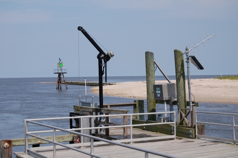
looking east toward Delaware Bay
The Murderkill Estuary is located in Kent County, Delaware, and drains to Delaware Bay at Bowers, Delaware. The 275 km2 watershed is primarily agricultural (55% ) but has 11% forest cover, 17% wetland cover (including forested wetlands), and 14% is builtup. This estuary receives water and associated nutrients from its watershed, its airshed, and from the Kent County Regional Wastewater Treatment Facility (KCRWTF). The KCRWTF receives wastewater from urban and suburban areas both within and outside of the Murderkill Watershed, including the cities of Dover and Smyrna, to the north, and Milford, to the south, serving a population of about 130,000. Thus, nutrient loading to the Murderkill Estuary represents both the population and land use of its own watershed and an additional larger and more urban source area. This site is operated by the University of Delaware in collaboration with the Delaware Department of Natural Resources and Environmental Control, US Geological Survey, and the Kent County Department of Public Works in order to monitor the estuarine response to nutrient management activities in the watershed.
Configuration
39° 03' 29.9" N 75° 23' 51.4" W
Archived Data
Use LOBOviz to graph and download archived data from this LOBO node.
Other Data For This Site
USGS National Water Information System Murderkill River at Bowers Delaware (01484085)


![]()